| |
| Map Products |
| GPS Products |
| Projects |
| Community |
| Contact |
| Community |
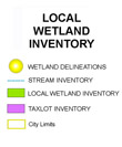
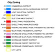
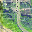
Development of a unique GIS application that is currently being used by rural cities in the Columbia Pacific region to access taxlots, addressing, zoning, elevation and other important (spatial) information. Recently Cartomation has been experimenting with the addition of non-spatial information in municipal GIS The application makes small cities along the coast operate more efficiently by providing an easy way anyone can access documents a GIS map. |
| GETTING TO THE MAPS | ||
|
||